 Saturday
Map and Directions
Saturday
Map and Directions
Tahoe Rim Trail from Mt. Rose Highway to the Ponderosa
Ranch, Sept. 18
A Little About the Route:
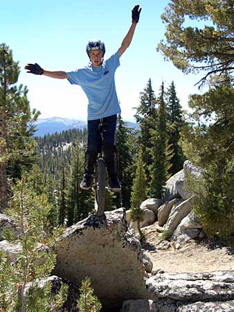
We will be riding a small, bike-legal section of the 162-mile Tahoe Rim Trail.
This rail completely circles the lake, and shares some sections with the Pacific
Crest Trail. The paved road around Lake Tahoe is 72 miles in length. We will
start our ride from the Mt. Rose Highway, between the Diamond Peak and Mt. Rose
ski resorts. Riders will come out on Highway 28 in Incline Village, near the
Ponderosa Ranch. This is a shuttle ride.
Directions to Starting Point:
As the crow flies, it's not very far from Lloyd's house. But by car you should
allow 45 minutes. Take Highway 267 south, just like you did for Northstar (seen
Northstar directions). Continue south
past Northstar. Follow 267 down to Lake Tahoe, where it dead-ends into Highway
28 at a traffic light. Turn left. Follow the north shore of Lake Tahoe for several
miles. The lake should be on your right. When you pass casinos, you will know
you're in Nevada. Shhh! Yes, this whole ride is in Nevada! A few miles past
the casinos, you will turn left at a traffic light onto the Mt. Rose Highway,
also known as 431. Follow 431 up, and up, and up. It is approximately 8 miles
to the trailhead. Before you reach it there will be a scenic view parking area
on the right. The trail should be within a mile past that, on the right side.
If you reach the summit and start heading downhill, go back about one mile before
the summit. There is parking along the road, and the trailhead may be marked
"Tahoe Meadows."
From the Nevada Side:
If you are in or around Reno, it's quicker to come up the Mt. Rose Highway from
the other side. Take Highway 395 South out of Reno, and look for a big intersection
with 431, the Mt. Rose Highway. Turn right there and follow that road. It will
take you up past the Mt. Rose ski area, and about one mile past the summit you
should see the trailhead on your left.
For Shuttle Drivers:
We will be parking one or more cars down near the Ponderosa
Ranch for the shuttle. Do not park in the Ponderosa Ranch parking
lot! They don't mind us being picked up there, but they may tow
you if you park for cycling. There is street parking just outside the Ponderosa,
or in the immediate vicinity. The Ponderosa Ranch is on the south end of Incline
Village on Highway 28. Just follow the shore of Lake Tahoe until you see it
on your left.
Driving down from the trailhead, follow Mt. Rose Highway back down, and turn left on Country Club Drive. This should be about 6 miles down from the trailhead. Country Club is a shortcut down to Highway 28. Turn left at the light onto 28 (Tahoe Blvd), and follow it down to the Ponderosa, 1 mile or less on your left.
If you get lost you can try my cell: (916) 257-2662.
Note: Trailhead location
on this map is approximate. Look for parked cars (on the shoulder) and a trailhead
sign. The trail
goes between the Trailhead and Ponderosa Ranch locations, but I don't know the
exact path so it's not shown.
Return to MUni Weekend 2004 page