Sunday Maps and Directions
Downieville, Oct. 19
Directions to Downieville:
It's a long haul, so we have to leave early. 6:45 from the Foss house. Drive
time is 2.5–3 hours. I-80 East to Auburn. Exit on Highway 49, and turn
left at the light to follow 49 north. After about 25 miles you will pass through
Grass Valley and into Nevada City. Keep your eyes peeled in Nevada City for
49 to make a left turn off the road you're on. Make sure you stay on 49 after
Nevada City! Continue for another 40 miles or so of windy 2-lane road. Try
not to get car sick. Eventually you will reach Downieville! Both of the shuttle
companies are located on Main Street, which is also 49.
-
Downieville Outfitters: 208 Main St. - (530) 289-0155
-
Yuba Expeditions: At intersection where 49 makes a right turn off Main Street - (530) 289-3010
If you get lost, best bet may be to call one of the shuttle companies. They know the way better than us!
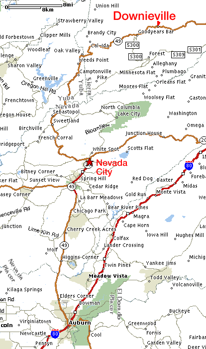
Downieville: Directions
are simple, but the ride is long. Don't miss the left turn in Nevada City!
The top of the trail, at Packer Saddle, is somewhere off the right-hand edge of the map, at the top. Anyone driving up there will be able to get directions from the shuttle companies. Trail maps will be provided in Downieville.
Return to MUni Weekend 2003 page